EN
Mapping San Siro
Supported by the Department of Architecture and Urban Studies and by Polisocial Program (Politecnico of Milan public engagement program), Mapping San Siro (MSS) was started in 2013 as a workshop activity, involving the participation of a group of students, researchers and teachers, interested in challenging the negative narratives associated to San Siro neighbourhood, one of the biggest public housing complexes of the city and in producing shared and “usable” representations that could effectively trigger local change. Thanks to the involvement of local actors, the workshop was particularly successful and a group of researchers decided to continue to work in the neighbourhood.
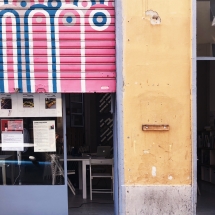
In 2014, MSS obtained from Aler – the Regional Agency for Public Housing of the Lombardy Region, which owns and manages the housing stock – the possibility to re-open a vacant shop in the neighbourhood, located on the street level, which became the headquarter of the group and was named “30metriquadri” (30 square metres).
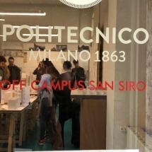
In 2019 – thanks to an agreement among Lombardy Region, Aler and Politecnico of Milan – Mapping San Siro became part of the Off Campus project and moved in a bigger space, just around the corner of the previous one. Off Campus San Siro is the first operating Off Campus space. The activities carried out here originate from the cooperation between university, inhabitants and local networks, coordinated by Mapping San Siro, the WRP research group and the Envisioning San Siro educational project.
The neighbourhood
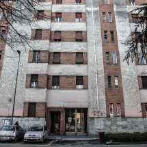
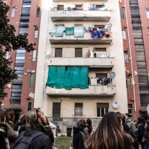
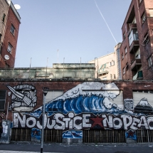
Located in the North-West part of the city, not far from the city centre, San Siro is composed of about 6.000 housing units and with a population of about 11.000 inhabitants, the neighbourhood is characterized by the presence of fragile populations and by strong socio-spatial inequalities and intercultural/intergenerational conflicts (around 50% of the population are immigrants, with about 85 nationalities represented). Despite being also characterized by the presence of diverse and strongly committed local actors (associations, cooperatives, groups of inhabitants), San Siro has always been heavily stigmatized in public discourses with the effect of worsening its exclusion from urban dynamics.
Main research themes
Mapping San Siro action-research is oriented on three main themes: home and dwelling; courtyards, public and common spaces; vacant and underused spaces.
The three research themes are the result of the first investigation phase (2013 workshop and its design-phase) which made it possible to detect which were the main critical issues for the neighbourhood. At the same time, these broad and transversal themes allowed the group – especially in the first phase of the research – to picture a “critical and complex framework” of the context as a whole.
The research on these issues is conducted by the team through the collection of both quantitative and qualitative data (such as qualitative interviews and life-stories) that make up what we have called a multi-source observatory. Indeed, since San Siro is characterized by the lack of clear and certain public data, it is essential to try to combine different sources of knowledge, especially giving value to local knowledge.
Over the years, additional research topics have been added: local networks and competences; local schools and intercultural education; territorial and individual memories; urban living labs in marginalized areas.
Methodology
Our research tools were developed experimentally and modelled over time to adapt to the needs of interaction with the territory.
The methodological tools activated were conceived to respond to three main objectives: to renew the methods of production of academic-scientific knowledge; to produce shared and usable knowledge through a strong relationship with the territory; to promote University’s public engagement in the city.
Looking back, we can recognize four main methodological tools that define and guide our work in the field:
Situating (being in the neighbourhood/building local relationships/opening-up a space and taking care of it);
Networking (building local and city-level/broader networks);
Inquiring (doing research and communicating it);
Acting (fostering local change through small and participated actions).
To know more about San Siro neighbourhood:
San Siro Stories – Magzine and website (designed by the Master in Journalism – Cattolica University of Milan with the collaboration of Mapping San Siro)
Here you can also find the maps Inside the neighborhood and Discovering San Siro designed in 2018 by Arjama Mukherjee e María José Jiménez (interns at Mapping San Siro)
To know more about Mapping San Siro check our main publications in English:
Castelnuovo, I., Cognetti, F. (2019) “Mapping San Siro Lab: Experimenting grounded, interactive and mutual learning for inclusive cities“, Transactions of the Association of European Schools of Planning, 3(1)
Castelnuovo, I., Cognetti, F. (2014) “Learning in Action. Mapping San Siro: an Exploration into City/University Collaboration“, in AEE Conference Proceedings
Cognetti F., Maranghi, E. (2019) “Adapting the Urban Living Lab approach to marginal contexts and urban regeneration: the case of Mapping San Siro Lab“, Proceedings of the Open Living Lab Days Conference (Thessaloniki – 2019)
Cognetti, F., Padovani, L. (2016) “New meanings for public housing estates through the co-production of knowledge – Findings from an action-research laboratory”, in Bargelli, E., Heitkamp, H. (eds), New Developments in Southern European Housing. Pisa: Pisa University Press
De Carli, B. (2014) “Informal trajectories of housing in San Siro, Milan”, in Cellamare, C., Cognetti, F. (eds) Practices of reappropriation. Milano: Planum Publisher.
You can also check:
SoHoLab Project website and have a look at the two reports produced: “The regeneration of large-scale social housing estates” and “Towards a definition of socially oriented urban living labs”
More likely to watch a video?
Here you can find a video on Mapping San Siro workshop
Here you can find a video on Mapping San Siro as a situated learning process (realized for Polimi Open Knowledge – Erasmus+ Project Design for inclusion)
